
Item Description: “Jenkins Ferry, April 30 1864” (map), [Captain Richard Morton Venable, chief, Topographical Bureau for the District of West Louisiana and Arkansas, Confederate States Army].
Note: On April 29 and 30, 1864, Union troops fended an attack by Confederates troops at Jenkins Ferry in south central Arkansas. On 30 April Union troops retreated to Little Rock by crossing the Saline River, which was fast-moving and swollen by heavy rains, using an inflatable pontoon bridge. Clicking on the map will lead a detailed record and image viewer with a zoom tool in the Gilmer Civil War Maps Collection.
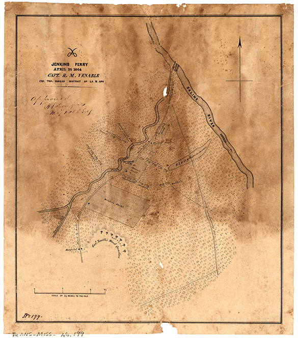
Citation: [Topographical Bureau for the District of West Louisiana and Arkansas, Confederate States Army.] Jenkins Ferry (map). 2.5 inches=1.0 miles. Map number 199 in the Jeremy Francis Gilmer Papers #276, Southern Historical Collection, Wilson Library, University of North Carolina at Chapel Hill.