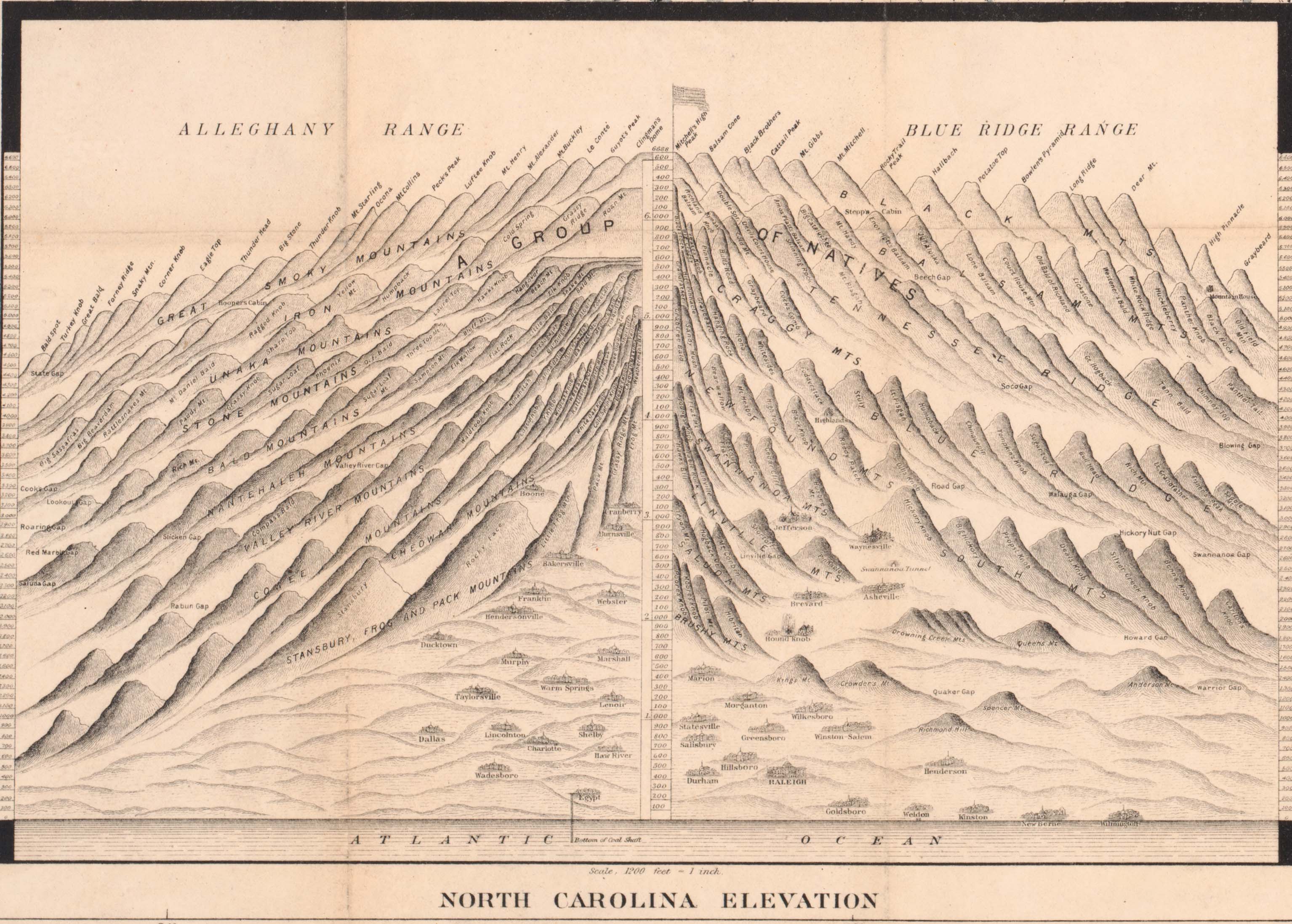
I found this great illustration showing North Carolina elevations in the corner of Shaffer’s Township Map of North Carolina, published in 1886. Click on the image for a much larger version.
This is an interesting way of showing the relative elevations of North Carolina towns and mountains from the lowest point, the bottom of the coal shaft at Egypt, N.C. to the top of Mt. Mitchell.