We just added a great coastal map from 1822 to the North Carolina Maps site. The “Chart of the coast of North Carolina comprising the three Capes Hatteras, Lookout, and Fear, with the Harbors of Ocracock, Beaufort, and Smithville,” by Robert H. B. Brazier, shows exactly why the waters off of North Carolina were known as the “Graveyard of the Atlantic.” The map details many of the shifting currents, shallow waters, breakers, and changing inlets along the Outer Banks.
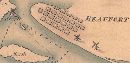
My favorite details on the map are the windmills shown in Beaufort and on Pivers Island.