Wachovia, North Carolina

The recent purchase of Wachovia Bank, discussed by Stephen below, will likely mark the disappearance of a historic North Carolina name from the corporate landscape. Wachovia was the name of the region in central North Carolina that was originally settled by the Moravians in the 1750s. The land was purchased from Earl Granville, and named after a location in Austria from which some of the settlers had emigrated. By the time John Collet published his map of North Carolina in 1770, of which a detail is shown here, the land had been divided, and the area called Dobbs Parish was the center of the Moravian community. The name Wachovia remained in use through the 1850s, when the nearby town of Winston was established as the seat of the recently formed Forsyth County.

Wachovia Loan and Trust Company

Wachovia Loan and Trust Company document

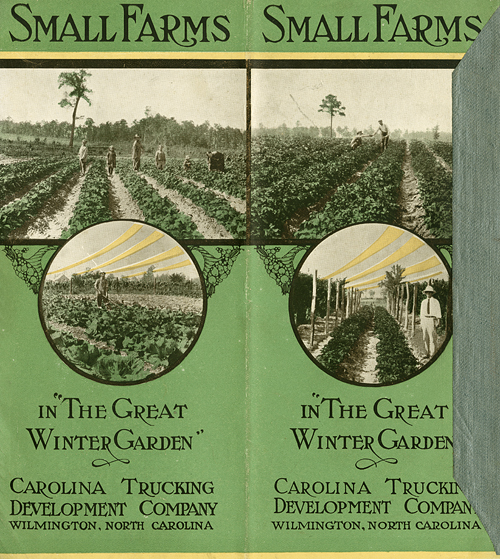
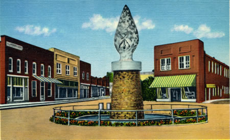
Charlotte-based Wachovia Corporation finds itself in the news today as Citigroup is buying out a major portion of Wachovia’s operations as part of the ongoing financial upheaval.  I headed to the Forsyth County folders in the photographic archives’ North Carolina County Collection to see what might be of interest to mark this eventful day in the state’s banking history, and found the document presented here.  The donated document finds itself in the photographic archive because of the illustration of the Wachovia Loan and Trust Company’s first permanent building in Winston, N.C.  It is also fascinating to note that the letterhead proclaims the trust company’s capital at $200,000—about $5.5 million today.

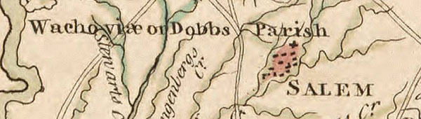
Founded in 1893 after state legislation permitting the creation of trust companies in 1891, Wachovia Loan and Trust Company was distinct from Wachovia National Bank founded in 1879.  The two institutions merged to become Wachovia National Bank and Trust Company on January 1, 1911.

Though not directly concerned with Wachovia, the content of the message, dated April 1st 1901, might be interesting to historians of the state’s banks. Thomas Maslin, listed in the 1906 Winston-Salem directory as the assistant treasurer and secretary at Wachovia Loan and Trust Company, wrote to John Tate of Charlotte, N.C., requesting “the names of the gentlemen of your city who are actively promoting the organization of a new Trust Company . . . the title of which is to be Southern States Loan and Trust Company.”  Maslin wanted to know because he had “several friends that will take stock as soon as they know something about what it intends to do, and I expect to run down to Charlotte, as soon as I know the names of the gentlemen connected with it.”

Some quick catalog checking and Googling located no reference to a Charlotte banking firm by that name. The 1900-1901 Charlotte city directory has no listing for a John Tate employed in banking, only a traveling salesman for a mills supply company.  There was listed a Southern Estate, Loan & Trust Co., but the “Farmers and Merchants National Bank” to which Maslin refers was actually the Merchants and Farmers National Bank.

Maslin suggested that Tate contact John M. Miller, listed in the 1900-1901 Charlotte directory, as the Merchants and Farmers cashier. Five years later in the 1905-1906 directory, there is listed a Southern Loan and Savings Bank that occupies the same building as the Southern Real Estate and Trust Company, and the two firms—with different operating officers—share a joint full-page advertisement.

Does anybody have any additional information to help fill in the story?

Vote For Me: Pinback Buttons Poster

The North Carolina Collection and the NCC Gallery held a very nice event last night, focusing on the Gallery’s current exhibit, “SOAPBOXES AND TREE STUMPS: Political Campaigning in North Carolina.” Lew Powell, forum editor for the Charlotte Observer and donor of the Lew Powell Memorabilia Collection, gave a gallery talk, highlighting items from his collection that were used in the exhibit. In addition, Rob Christensen, political columnist for the Raleigh News and Observer, spoke about his recent book, The Paradox of Tar Heel Politics: The Personalities, Elections, and Events That Shaped Modern North Carolina. In honor of the event and exhibit, the North Carolina Collection created a keepsake poster (partial image below). The pinback buttons used in this poster can all be found in the Powell Collection at the North Carolina Collection, Wilson Library. Thanks to the hard work and web wizardry of Andy Jackson from the Davis Library Systems Department, you can view and read about all of the buttons featured in the poster at Vote For Me: Political Campaigning in North Carolina (2008 Poster).

Politicking, North Carolina Style

From now until November 4, we are going to share with our readers some of the political ephemera and memorabilia that the NC Collection collects and maintains. Today’s feature is a pamphlet from the 1968 Democratic primary race for lieutenant governor, which featured the first female candidate for that position, Margaret Harper. Prior to running, Harper was a businesswoman and newspaper administrator, serving as the editor of the The State Port Pilot while her husband was in the military during World War II. Though she did not receive the nomination, Harper did win 23 percent of the vote. She tried again and lost again in 1972…this time garnering 20 percent of the vote.

The Great Winter Garden

Small Farms in "The Great Winter Garden"

My research for an exhibition this coming February has led me to a pamphlet, Small Farms in “The Great Winter Garden” published in or about 1915 by the Carolina Trucking Development Company, owed by Hugh MacRae, in Wilmington. The pamphlet’s purpose is to describe and offer for sale farms and homes owned by the company—with illustrations, facts, and statistics aplenty—as part of its larger effort to create agricultural colonies in the area. What interests me at this stage of my digging is the slogan, “The Great Winter Garden,” created by the Bureau of Soils of the United States Department of Agriculture.

"Map of Eastern States showing location of Narrow Belt Along the South Atlantic Coast designated by the United States Department of Agriculture as the "Great Winter Garden."

A map inside the pamphlet illustrates its geographic range along the mid and southern Atlantic coast; I am trying to determine the date of its origin, and how widely the slogan may have been adopted. Initial explorations are yielding minimal leads. I’ve only located one thus far: an article entitled, “Truck Soils of the Atlantic Coast Region” by Jay A. Bonsteel in the Yearbook of the United States Department of Agriculture for 1912, which includes the same map used in the pamphlet. Do you know of other items or references to The Great Winter Garden?

Yarr! Me North Carolina mateys!

Avast, ye lovers of Carolina! This day, bein’ the Nineteenth of September, is mark’d as one where Ye Best to Talk like the Swashbucklers of Old, and the North Carolina Collection wants to help ye in yer endeavors. Practice yer pirate speak with our vast collection of Pirate Lore! Is it lusty affairs ye be after? Frank Shay and Sabrina Jeffries will quench yer thirst as with a flagon of ale. Brush up on yer historical knowledge of Anne Bonny and the infamous Blackbeard, the latter bein’ honored with a display out in the Readin’ Room this very day.

And if ye be needin’ some help, fear not that the friendly NCC staff will assist ye more bearably than these poor folk:

Sanitation in Sampson County, 1914

Forgive me for bringing down the typically high level of discourse on this blog, but I have a question about toilets. The fascinating Map of Salemburg community: from April 15 to Oct. 1, 1914 looks at the changing sanitary conditions of households in 1914, most likely in response to an outbreak of hookworm in the area. The progress of each house is charted, as explained in this detail from the map legend:

Now I understand what the numbers mean, and the symbol for owner or tenant, but what I can’t figure out are the abbreviations for different types of privies. The letters included in the symbols are most often “F” or “E” for the privies examined in April, and mostly “B” for those examined in October. There is nothing else on the map to suggest that they might represent. Do you think these are just codes used by the sanitary commission, or do they stand for specific words? (Flush? Bucket?) Please, keep your answers clean.

Roads?

If you’re like me, you’re having a blast surfing around the new North Carolina Maps digital project. However, all of the great information on these maps can be a little overwhelming at times. One website that we have found to be particularly useful in figuring out information about North Carolina roads is NCRoads.com Annex: More Highways of North Carolina. The site has maps, routes, dates of creation, and comments on state and federal highways and interstates. Thanks to loyal contributor and NC Miscellany “founder” Nick Graham for pointing this out!