I’m excited to announce the release of the beta site for North Carolina Maps, the historic map digitization project by the North Carolina State Archives, UNC-Chapel Hill University Library, and Outer Banks History Center.
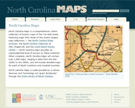
The site currently includes over 750 maps, primarily from the State Archives and the North Carolina Collection. Maps from the Outer Banks History Center will be added in the fall. There is an impressive variety of maps on the site, including many of the earliest maps of North Carolina, state highway maps, Coast and Geodetic Survey maps, and — my personal favorite — soil survey maps. North Carolina Maps also includes at least one map for each of North Carolina’s 100 counties.
New maps and features will be added to the site on a regular basis over the next two years. North Carolina Maps is made possible by a Library Services and Technology Act grant distributed through the State Library of North Carolina.